Estimating household wealth using satellite data
PLUS: predicting urban landscape changes, measuring drinking water shortages, free internet coverage dataset and more.
Hey guys, here’s this week’s edition of the Spatial Edge — a weekly round-up of geospatial news. We put the ‘fun’ in ‘foundational models’. Wait a minute…
In today’s newsletter:
Granular wealth estimates: How to estimate household wealth using satellite data
Predicting urban landscapes: Realistic depictions of urban change
Thirsty for data: Measuring drinking water shortages using geospatial data
Internet inequality: Free datasets on internet coverage
Research you should know about
1. Estimating granular changes in wealth over time using satellite imagery
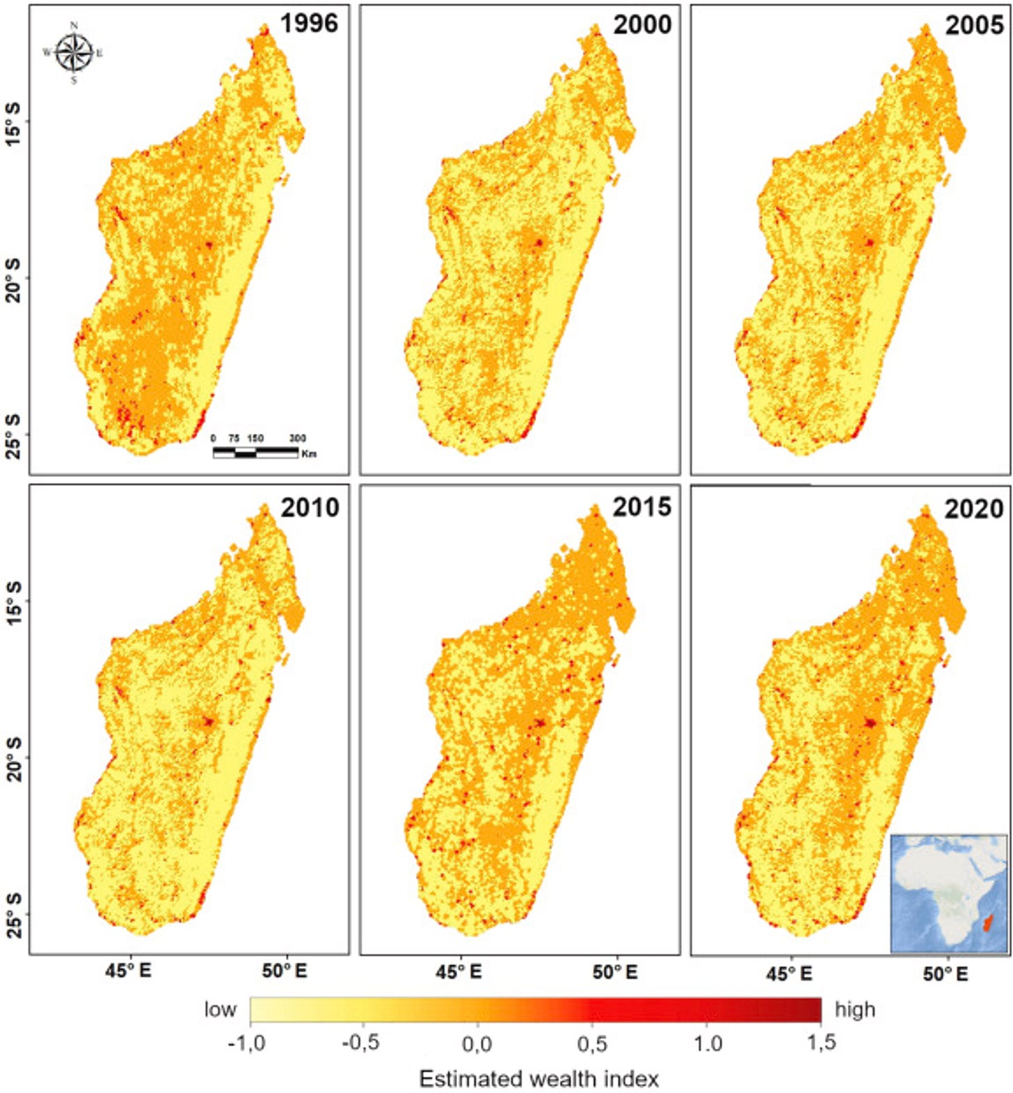
New research has found a way to use daytime and nighttime satellite imagery to come up with granular estimates of wealth over time.
Unlike other approaches, which use deep learning and satellite data to predict poverty, this paper provides time-series data. The authors use data from the Demographic and Health Surveys and satellite imagery for 24 countries to train a deep learning model.
They then tested the model on new locations in Madagascar, Brazil and Japan. They found the model performs well across a bunch of different regions, and achieved a high degree of accuracy in estimating wealth indexes (R^2 of 0.69).
FYI, the code has been made open source.
2. Predicting What Urban Landscapes Look Like in the Future
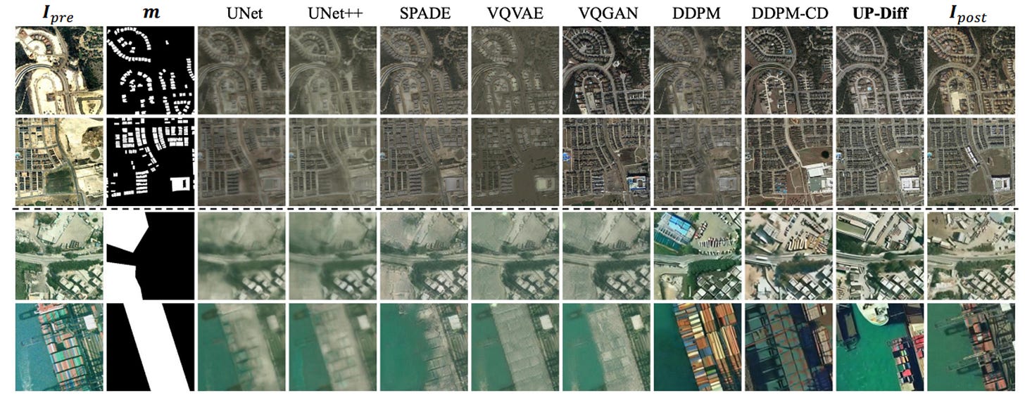
A new paper is using data from urban layouts and maps on planned urban construction to provide satellite-image style predictions of future urban landscapes.
The paper uses a latent diffusion model (UP-Diff) to predict urban landscapes for Texas and Hong Kong. This type of info might be able to help with city expansion planning, zoning and land use, developing transport networks and planning utilities — in other words, urban planners would love it.
3. Using geospatial data to estimate drinking water shortages
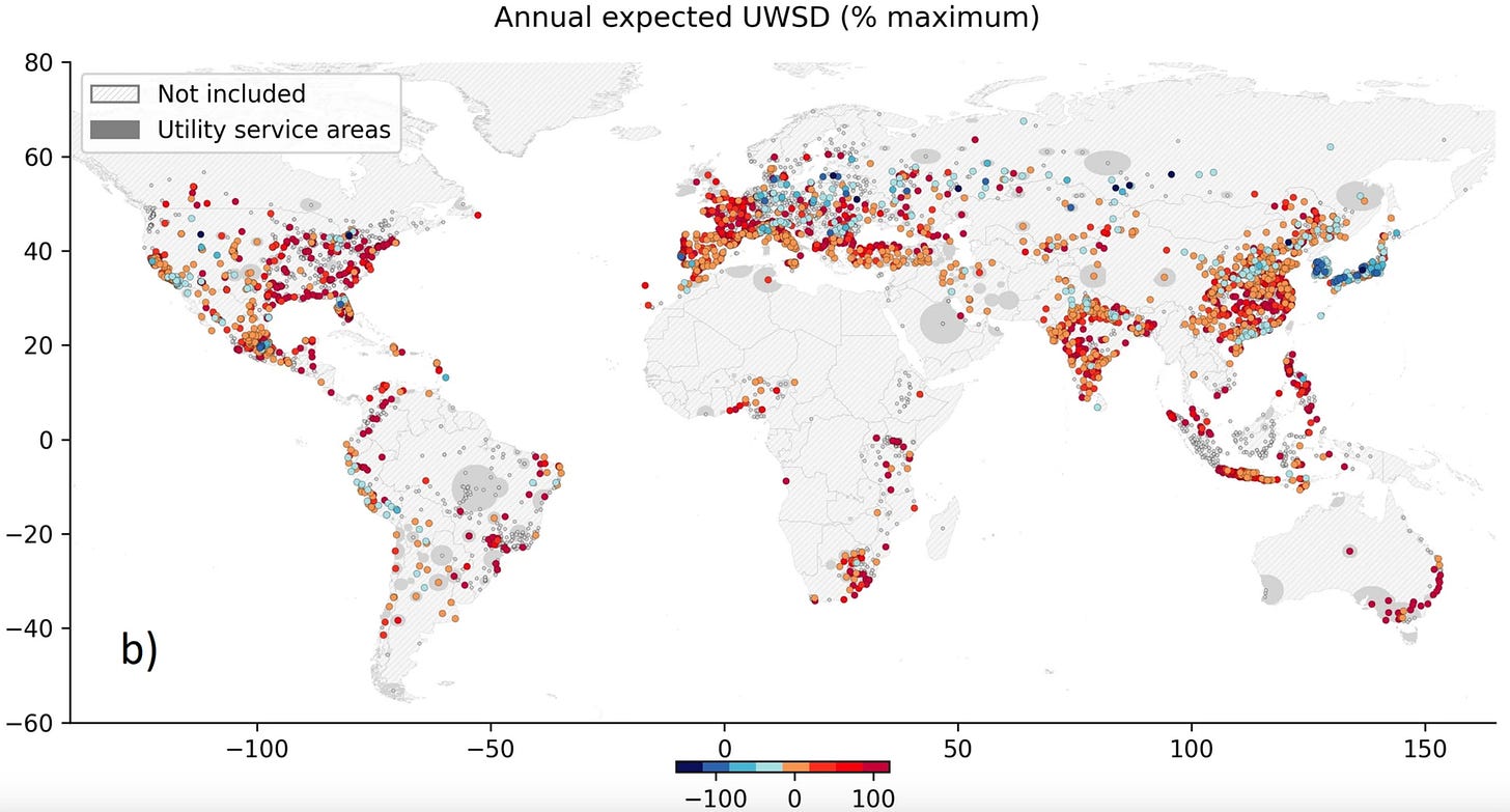
A new paper in Nature Communications introduces a way to assess drought risk for 5,600 water supply utilities and evaluate adaptation actions. The study looks at current and future risks under a bunch of different climate and socioeconomic scenarios.
The paper finds that:
48% of water utilities currently face drought-related disruptions, with 15% of their supply being unsustainable on average.
Future Risk: By 2030-2060, global drought risks are expected to increase by 30-45%. Water utilities in countries like Botswana, Ecuador, Mexico, Morocco, South Africa, and Pakistan are most vulnerable.
90% of at-risk water utilities would benefit from 3 types of adaptation strategies: (i) reducing leaks (best for 60% of systems), (ii) desalination (best for 10%), and (iii) increasing storage capacity (best for 30%).
However, implementing these options would require an annual investment of $20 billion.
Geospatial Datasets
1. Land cover dataset from OpenStreetMap
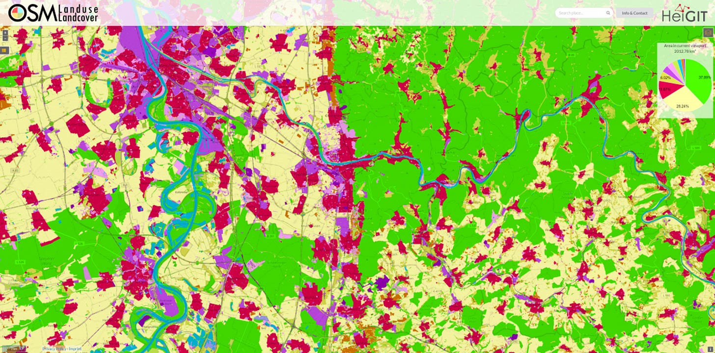
OpenStreetMap’s Landuse dataset is now freely available. It classifies land at 10m resolution, in a bunch of categories such as forests, urban fabric, water bodies, pastures, mines, etc.
2. Internet connectivity data from Ookla and M-Lab
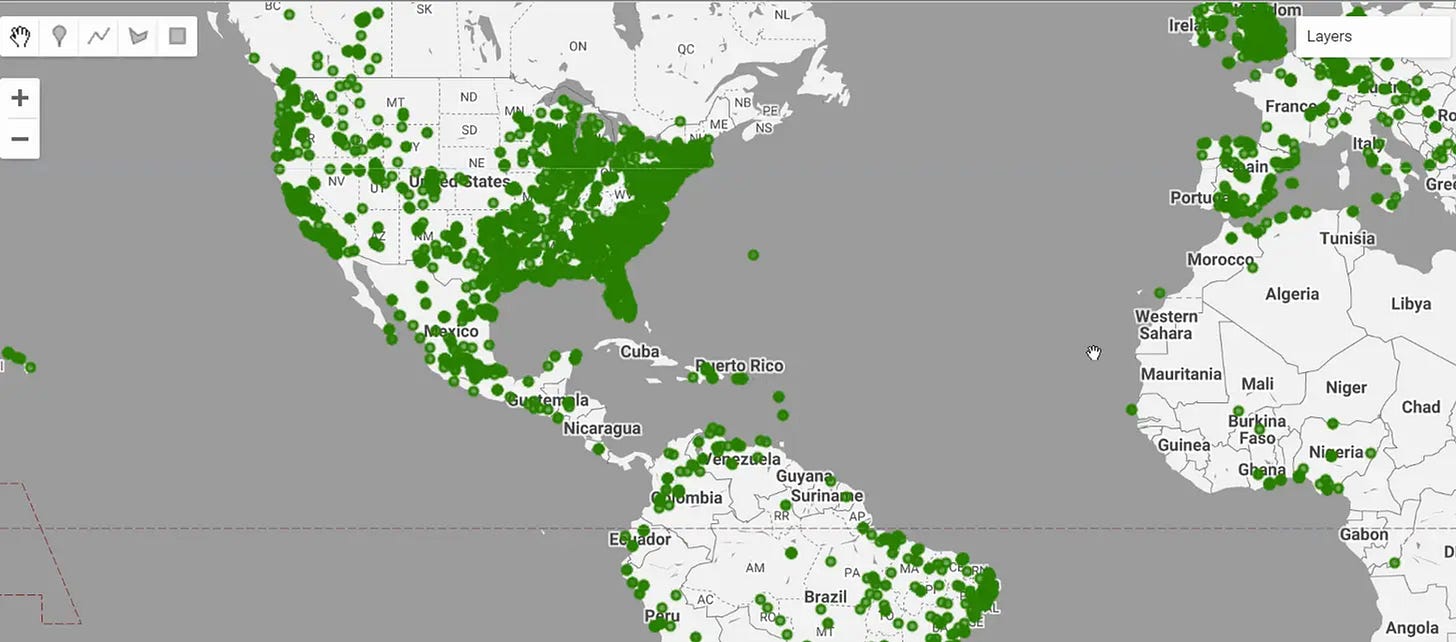
Google Earth Engine Community Catalog now features datasets on internet connectivity from two providers: Ookla’s Global Fixed Broadband, Mobile and 5G datasets; and M-Lab’s Network Data Extracts.
We can use these datasets to view inequalities in internet access and develop policies to promote internet access across the world.
3. OAM-TCD: A globally diverse dataset of high-resolution tree cover maps
In the geospatial world, classifying trees is cooler than Drake.
So it’s great that a new dataset provides labelled data on trees to help train classification models. This comes off the back of some new datasets looking at tree cover, such as the Tree Canopy Height geospatial dataset from Meta and World Resources Institute.
4. XTraffic: Unlocking traffic predictions and analyses
Researchers have put together a new traffic dataset to help unlock a bunch of new traffic analyses such as: post-incident traffic forecasting, incident classification, and causal analysis. The dataset has been collected from 16,972 sensors across 42 cities and counties.
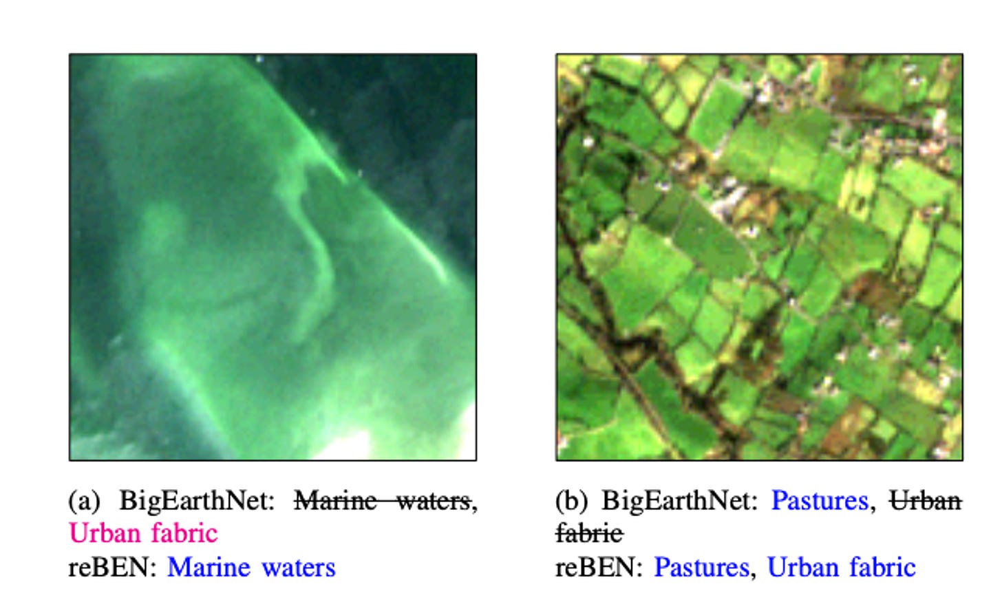
5. Refined BigEarthNet Dataset for Remote Sensing Image Analysis
ReBEN is an improved large-scale remote sensing dataset designed for deep learning. It contains 549,488 pairs of image patches from Sentinel-1 and Sentinel-2 satellites, each measuring 1200 m x 1200 m. Each patch is linked with pixel-level reference maps and scene-level labels.
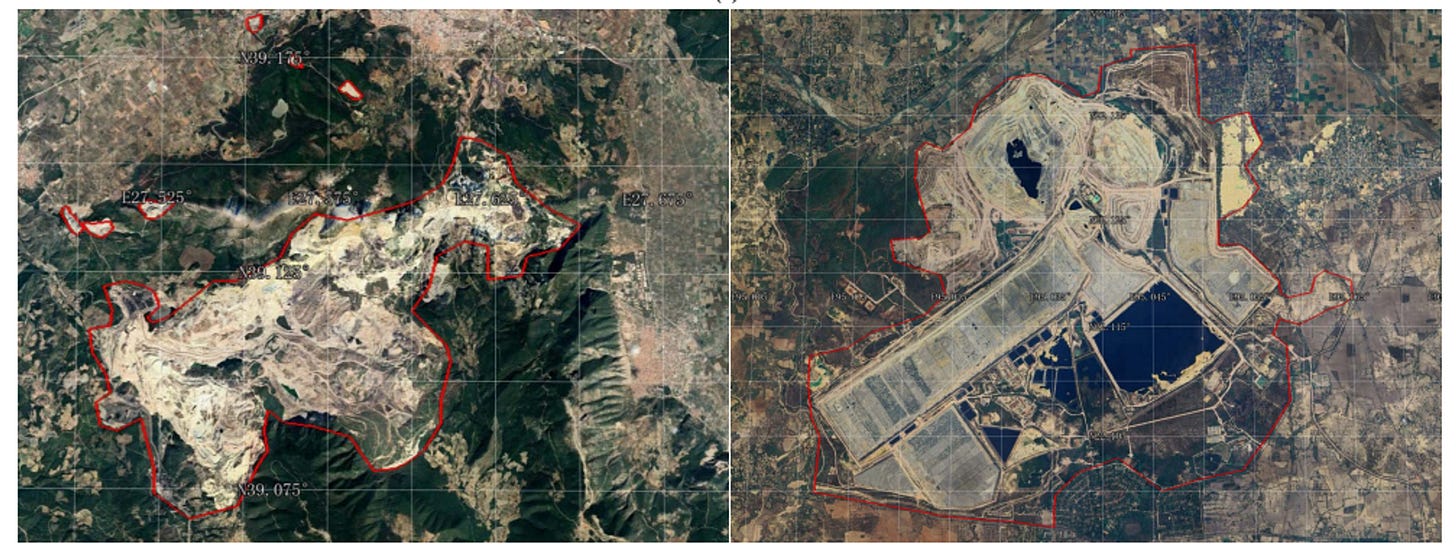
6. Change detection from Mining
MineNetCD is a dataset with over 70,000 pairs of high-resolution remote sensing images taken at different times. Using this dataset, a model is built that uses over 13 change detection models, to help identify changes in a landscape caused by mining.
The model framework is Designed for efficient processing using the HuggingFace cloud platform.
Other useful bits
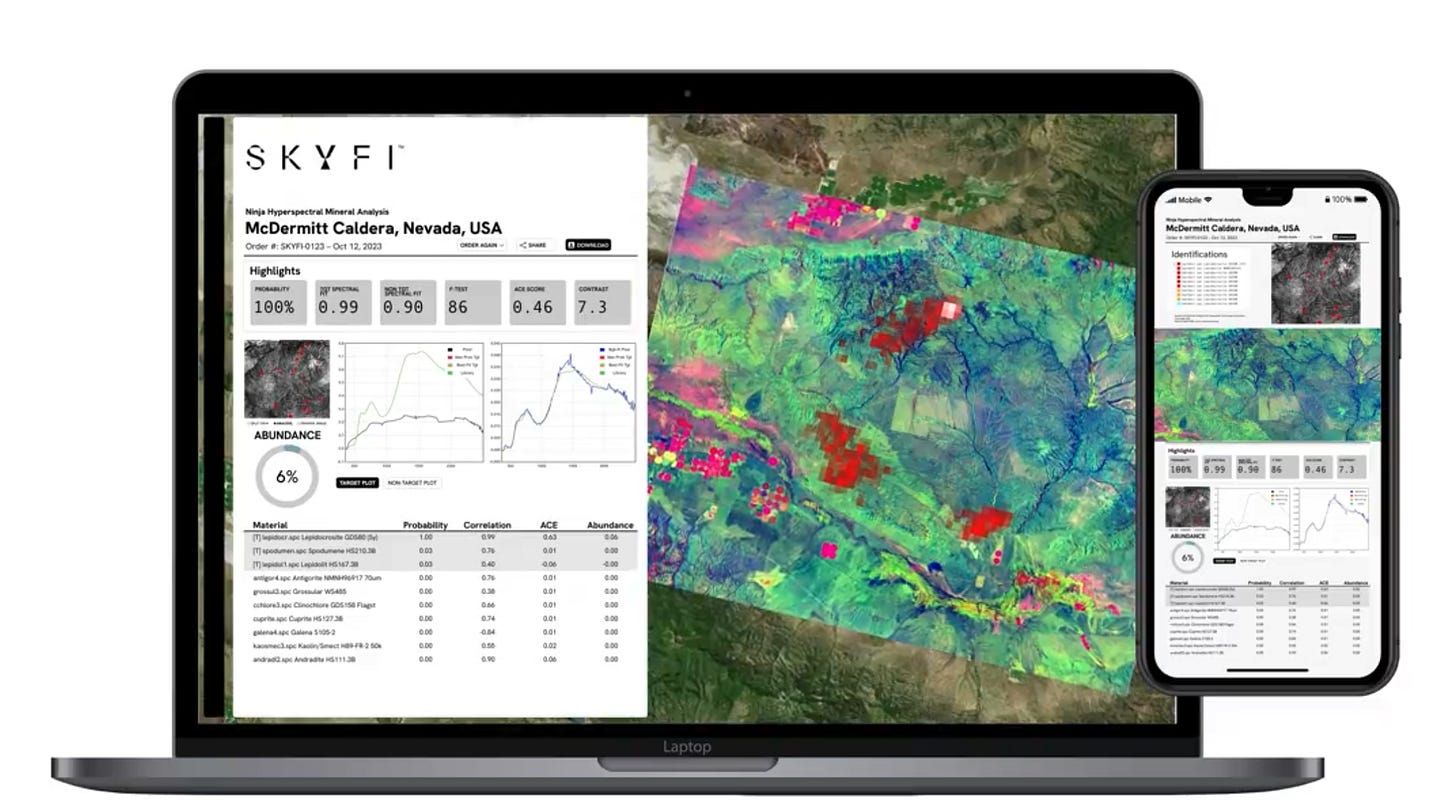
SkyFi has announced a partnership with Geospatial Technology Associates to integrate hyperspectral analysis onto their platform.
A new Python package, AirPy, helps users extract high-resolution data from Google Earth Engine to assist with conducting air pollution studies.
NASA Harvest has released new estimates of winter crops in Ukraine. They provide insights on crop production for government-controlled and Russian-occupied regions.
Jobs
UNDP is looking for a GIS Associate and GIS Developer in New Delhi.
SpaceKnow is looking for a Machine Learning Engineer for Geospatial AI.
Amazon is looking for a geospatial data engineer. The position will be responsible for Amazon World-Wide Sustainability’s geospatial data, including ingestion, documentation, quality, and metadata management.
Development Seed is recruiting a Geospatial Services Engineer to develop geospatial data services and advance open-source geospatial technologies.
The United States Geological Service is looking for a fellow specialising in remote sensing of agricultural practices.
That’s it for this week.
I’m always keen to hear from you, so please let me know if you have:
new geospatial datasets
newly published papers
geospatial job opportunities
and I’ll do my best to showcase them here.


